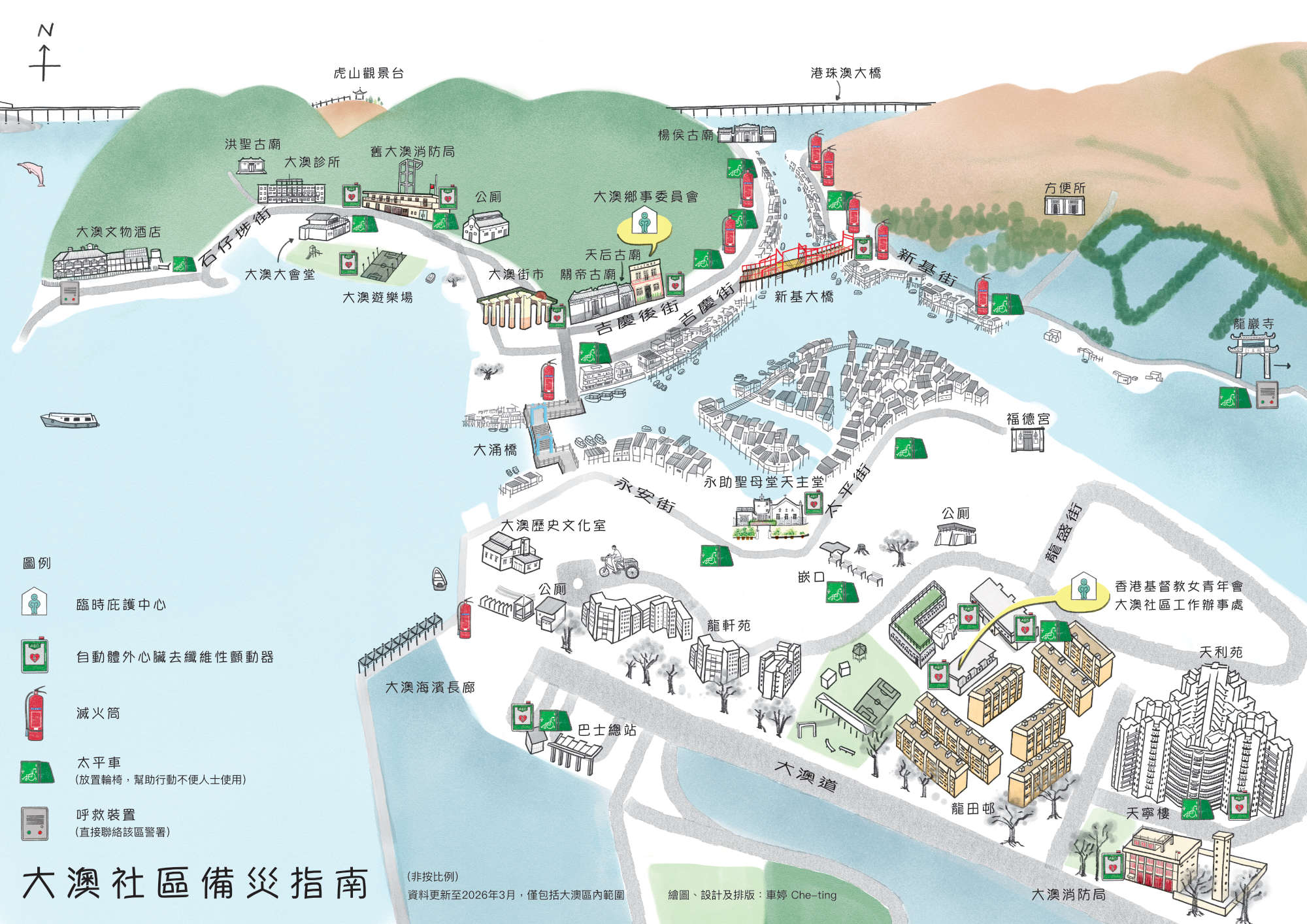
“Tai O Community Disaster Preparedness Guide” translates emergency preparedness into a community-centric map for Tai O residents. Developed through participatory workshops with locals, the design balances functional clarity for emergency contexts and mark key safety equipment like AEDs, fire extinguishers etc. with the unique cultural identity of the fishing village.
Intuitive layout grounded in local narrative:
1|Ham Hau: Historically defined by a great banyan tree, remaining a natural community gathering spot over time.
2|Fuk Tak Kung To Tei Temple: A 200-year-old cultural heart on Tai O Tai Ping Street, home to the annual Earth God Festival.
3|Our Lady of Perpetual Help Chapel: An architectural focal point offering panoramic rooftop views over Tai O’s iconic stilt houses.
By integrating shared spatial memory into emergency planning, safety data is transformed into a functional map with heart.
Illustration & layout design by Che-ting
Commissioned by Hong Kong Red Cross